-
GeoSLAM traj_ref.txt – Export Reference Points
Lately, after buying our GeoSLAM system we did our first campaign and we found out we needed to Export Reference Points from the processed data.This operation used to just work with GeoSLAM Hub, unfortunately we cannot use GeoSLAM Hub to process data as our scanner is equipped with the GeoSLAM Vision camera, that is only…
-
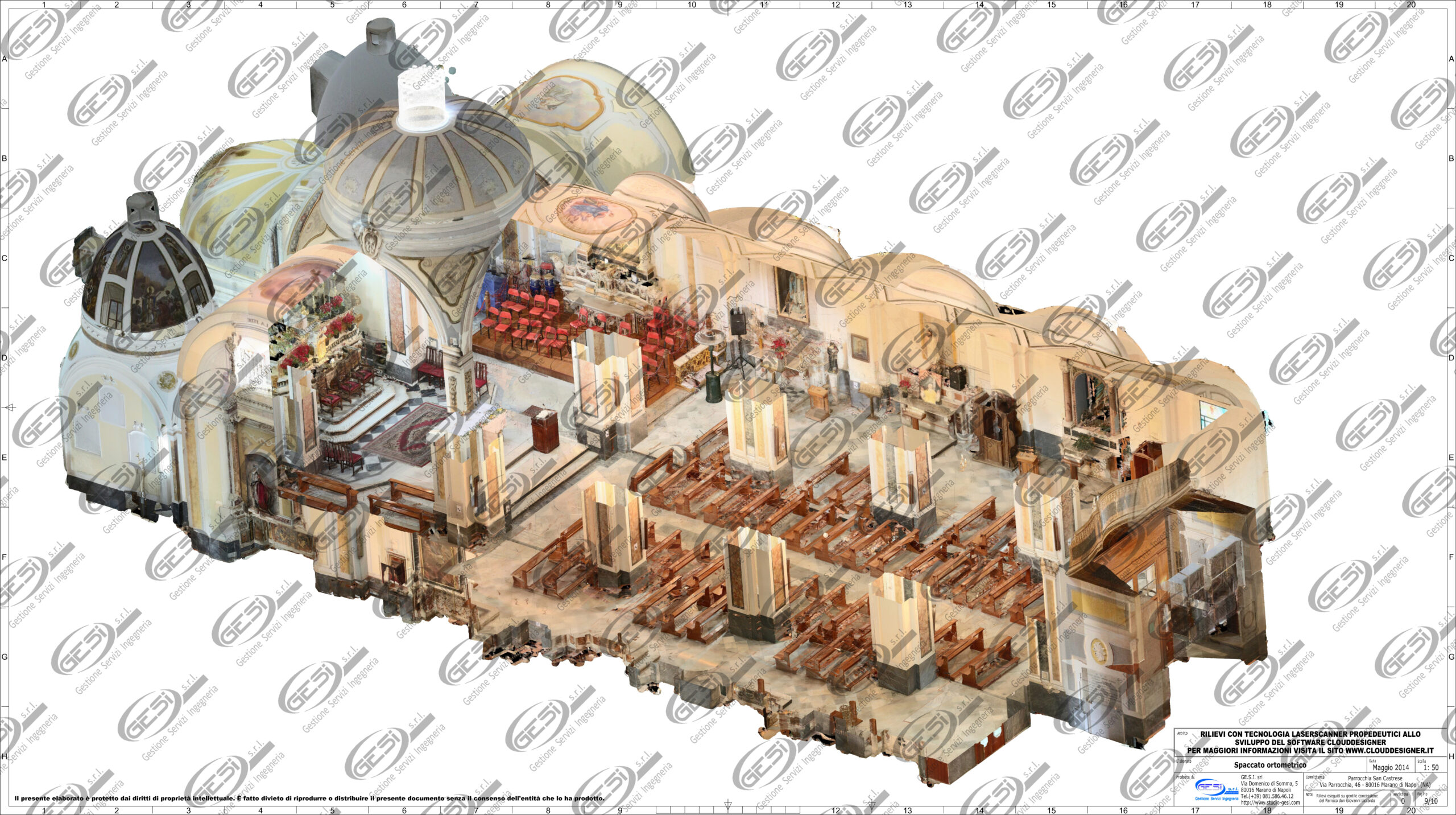
An entire project in 6 hours

Our work is made up of not only dedication, professionalism and passion but also research and development. Our experience with the Laser Scanner began in 2013, when we decided to invest in the purchase of the Laser Scanner instrumentation along with its software kit. After taking the course to use the entire package, we clearly…
-
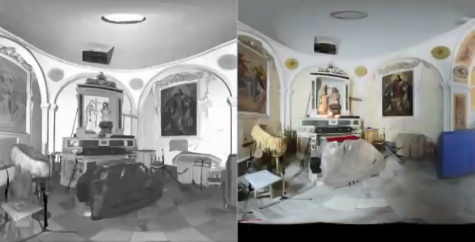
How do we coulorize our pointclouds?
“Working with intuitiveness means to be close to a great mind!” We thought we had created a unique method in giving color to our papers, but we have recently discovered that this method already existed and was already used as many as 100 years ago! In fact, the way we operate during Laser Scanner topographic…
-
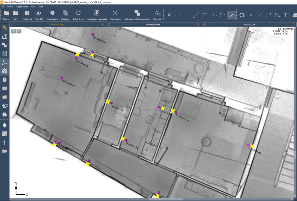
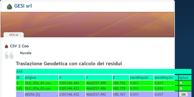
Rototranslating Clouds with submillimetric residual or sub-gap
It is the small details that are unnoticeable and decide everything. Detecting reality as it appears to us can be done with the right technique and instrumentation. Studying multiple cases and comparing our experience in the field we can sum it up as follows, “Noise affects the accuracy of the detected data, and a lack…
-
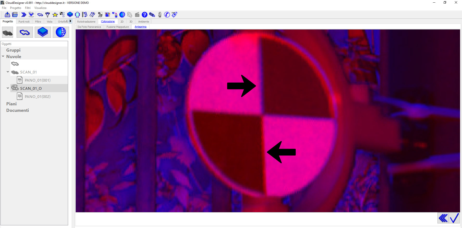
Laser Scanner: Noise and Color – The Best Color for Targets
Each material, each color creates different noises.The noise affects the accuracy of the measured data.Keep in mind that precision is physically the ability to approach the same center, while accuracy is the ability of the measurement to be close to reality. What color should we use to print our targets? There is no single solution…
-
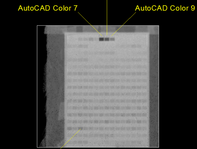
Analysis of the Graphical Rendering of Processes.
Laser Scanner surveys generate scenes that are built with constant angular resolution, therefore, the interspace between points on far surfaces (from the stationing) will be greater than the interspace between points on closer surfaces. This phenomenon is difficult to observe from the 3D View by placing oneself in the center of the scene that is…
-
GPS: a software to solve accuracy errors and much more
In topographic applications, the use of GPS in DGPS mode (whether RTK or PP) is subject to much greater accuracy errors than precision errors. The accuracy error is normally solved by moving through a known point. Due to its nature, however, GPS does not always survey with the same accuracy. Accuracy changes over time, indulging…