-
How to survey: from measuring tape to Laser Scanner

Surveying is often a cause for discussion since a wide variety of measurement techniques can be used. Each method of measurement comes with advantages, disadvantages and requirements in terms of time and personnel used. Survey by Measuring Tape and Laser Distance Meter (Direct Measurement) The survey by metric roll and laser distance meter involves measuring…
-
Topographic Laser Scanner: Time-of-Flight vs Phase-Shift
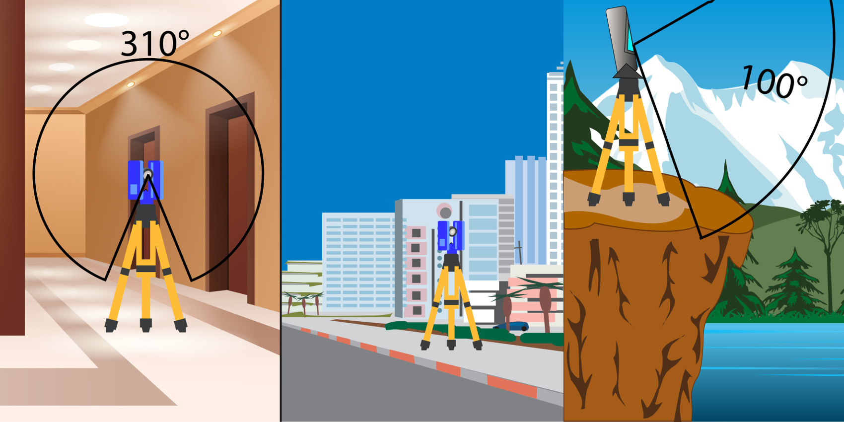
Laser scanners are instruments capable of capturing at high speed the surrounding reality in the form of three-dimensional points in space. These points compose a collective datum called the point cloud, composed of thousands or millions of individual points that are discontinuous with each other and organized in rows and columns so that each point…
-
Topographic surveys: how GPS works

GPS is an earth positioning system capable of detecting the exact location of a point in space, this tracking system was designed by the U.S. Department of Defense (DOD). GPS works through 32 orbiting satellites, plus some backup ones. These orbits are circular on 6 parallel orbital planes inclined 55° to the equatorial plane and…
-
Laser: risks, hazards coming from surveying instruments (Distance Meters, Total Stations, Laser Scanners)
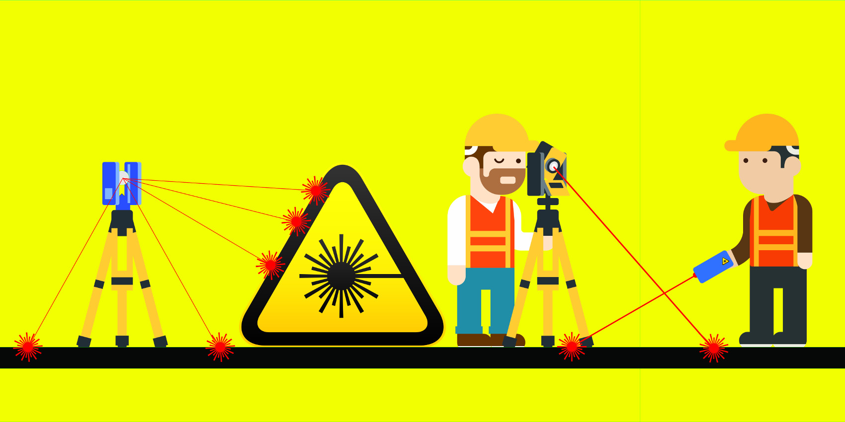
Can the use of high-precision devices endanger our health?To answer this question, it is necessary to learn more about the various types of lasers that exist, to know the potential risks caused by the instrumentation in use. The distance meter commonly is of this type: Classe 2 The total station, depending on the models, usually…
-
The multipath phenomenon

Multipath phenomenon occurs when a GPS survey is carried out near a reflective surface. In such a case, part of the satellite signal reaches the antenna directly in reverse, the remaining part will reach the antenna after some time because of the reflection it has undergone, thus giving rise to a position calculation error. This…
-
GPS: how did DGPS born?
Differential GPS (DGPS) was created for security reasons, given the excessive accuracy attainable by the GPS system since always. The U.S. Department of Defense introduced an intentional accuracy degradation system called Selective Availability, which was capable of providing nonmilitary receivers with performance that was still sufficient for many applications of practical interest but, significantly lower…
-
Laser Scanner and Privacy: how to protect trade secrets

Performing a Laser Scanner survey is, as of today, certainly the most objective and accurate method of surveying an object, a room, a building. However, while it is the best method of surveying, it can also be invasive, precisely because the goal of the scanner is to survey rooms as they are. Scene, however, might…
-
Topographic Surveys: how the Total Station works

The total station is topographic instrument used for indirect surveying. The instrument consists of an electronic distance meter, an electronic goniometer for measuring the azimuth angle, and a second electronic goniometer for measuring the zenith angle. The calculation of the data stored during the campaign phase, are stored through a computer with a user interface.…