-
How to survey: from measuring tape to Laser Scanner

Surveying is often a cause for discussion since a wide variety of measurement techniques can be used. Each method of measurement comes with advantages, disadvantages and requirements in terms of time and personnel used. Survey by Measuring Tape and Laser Distance Meter (Direct Measurement) The survey by metric roll and laser distance meter involves measuring…
-
Surveys for TV: the Cathedral of Amalfi

“The best solution to all the problems is patience “Study and research, dedication and application to push our work have always been the key to our success! The challenge was to reproduce any building as truthfully as possible in its dimensions. A result that was not obvious to achieve, in fact even though the Laser…
-
GPS: a software to solve accuracy errors and much more
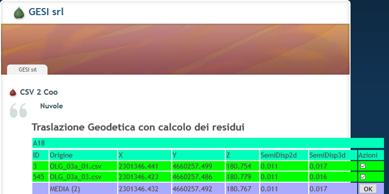
In topographic applications, the use of GPS in DGPS mode (whether RTK or PP) is subject to much greater accuracy errors than precision errors. The accuracy error is normally solved by moving through a known point. Due to its nature, however, GPS does not always survey with the same accuracy. Accuracy changes over time, indulging…